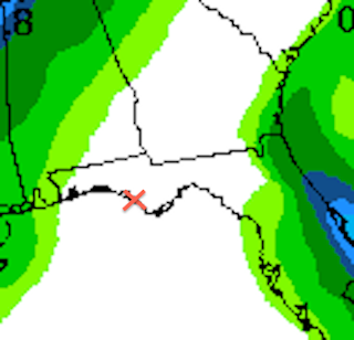
A succession of cold fronts is rolling across the country and will continue to do so under the current pattern known as "zonal flow", which simply means that the jet stream - the upper air current that steers weather systems - is flowing mainly west to east at the moment. Thus there are no deep north/south waves in the flow that could result in stalled storm systems and abnormally cold or wet conditions here at the beach. In fact the seven day precipitation outlook from the Weather Prediction Center (WPC) shows no precipitation accumulation in Santa Rosa Beach (the "x") through next Tuesday, Nov. 12th:
And as far as temperatures go this map - also from the WPC - shows the forecast high temperatures for the lower 48 states this coming Sunday. Check out the warm temps here versus further north(!):


No comments:
Post a Comment
Note: Only a member of this blog may post a comment.