Thursday, July 25, 2013

Goldilocks weather

Highs in the upper 80's, lows in the mid-70's, and chances for showers or thunderstorms almost every afternoon.  That pretty much sums up the outlook for Casablanca on 30A weather over the next several days.  The Weather Prediction Center provides this forecast graphic for the total amount of rain expected over the next five days:
Note that Santa Rosa Beach - the white cross - is in a shaded region indicating a total of 0.75 inches of rain, not a lot for a five day total in a subtropical locale.  Thus the "Goldilocks weather" designation:  not too hot, not too cold, not too much rain...juuuuuuuusttttt right for the beach!

A quick word about Tropical Storm Dorian:  most models indicate this storm will turn northward before reaching the East Coast.  If this trend continues the storm won't affect the Florida panhandle at all.  C'mon down, the water's fine!

Thursday, July 18, 2013

Escaping the heat at Santa Rosa Beach

With high temperatures soaring into the middle and upper 90's over much of the nation the thoughts of cooling seabreezes and a dip in the Gulf of Mexico sounds very appealing.  That, along with a dose of rainfall over the coming weekend, is exactly what Santa Rosa Beach and Casablanca on 30A bring to the table. 

A southerly wind flow at the surface and upper air levels will pump plenty of tropical moisture over the Florida panhandle the next couple of days.  This will enhance the normal afternoon showers and thunderstorms that occur this time of year.  Then, early next week, the air flow swaps around to the west and southwest helping things dry out a bit and provide more sunshine for the beaches.  Temperatures each day over the next week will top out in the upper 80's after morning lows in the upper 70's.

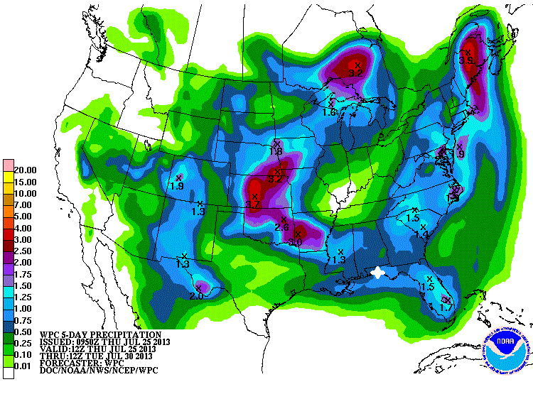
There will be some rainfall most days but nothing like the moisture totals the Panhandle saw last week.  This is a total rainfall forecast graphic from the Weather Prediction Center from this morning through Tuesday morning July 23rd:
The blue shading over most of the Panhandle represents a total of between 0.75 and 1.0 inch of rain spread over this five day period, which is pretty typical for the summer months.

Sound better than the 90's?  C'mon down!

Saturday, July 13, 2013

Rainfall should start tapering off next week

Whew!  The past couple of weeks have featured monster amounts of rainfall over much of the eastern U.S. and Santa Rosa Beach did not escape the deluge.  Check out this precipitation map for the first half of July.  It shows the percentage above normal rainfall:

At the yellow cross - representing Santa Rosa Beach - the area has received over 400% of the normal rainfall for the first half of July.  By any stretch that's a LOT of water.  The culprit is mainly the clockwise circulation around a robust Bermuda High off the East Coast that is pumping tropical moisture northward over the Florida panhandle.  This unmoving high pressure feature is "blocking" the forward progress of weather systems trying to move eastward across the country and the result is a series of "stuck" cold fronts squeezing out heavy rainfall over the same areas day after day.

This heavy rain will continue for the next couple of days as the precipitable water (PWAT) values remain very high.  Coupled with a tropical wave that will cross the Florida panhandle this moisture will provide another two inches of rainfall between now and Tuesday evening.  After that things should settle back down to "normal" Florida summertime weather with a chance of afternoon thunderstorms and highs in the mid to upper 80's.  Of course that means great beach weather!