If you're concerned about the Atlantic hurricane season affecting your Santa Rosa Beach vacation plans don't be. Even though seasonal activity usually ramps up from now until its peak in mid-September the action has fallen off quite a bit recently. Tropical storm
Dorian fell apart before it reached the Bahamas and its zombie-like remnants (they just wouldn't go away!!) have merged with a cold front that pushed off the southeastern U.S. coast.
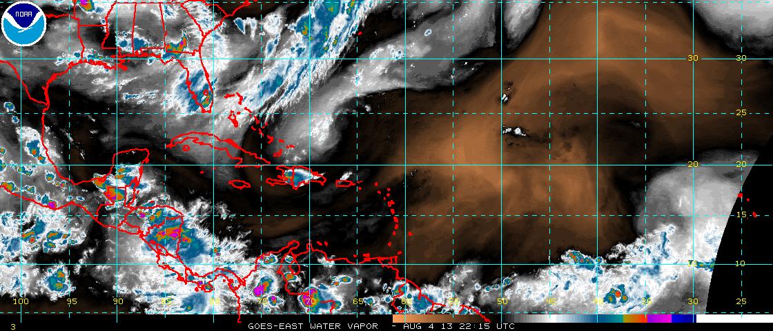
The rest of the Atlantic convective potential is being squashed by copious quantities of dry air and dust emanating from the Sahara desert as seen in this satellite image that shows water vapor:
The brown area indicates the dry air and associated dust over the Atlantic with no visible convection in this favored area for tropical development. As a result there is little or no concern from the National Hurricane Center regarding tropical storms that could affect the U.S. mainland for at least the next week. Satellite water vapor views of the Gulf of Mexico and the Caribbean Sea are equally devoid of convection.
So if you want to enjoy a great August vacation head on down to Santa Rosa Beach and check out
Casablanca on 30A. Along with the typical beach weather of high temperatures in the upper 80's and scattered afternoon thunderstorms the water temperature is in the mid-80's.
No comments:
Post a Comment
Note: Only a member of this blog may post a comment.